EMWIN/HRITthe Emergency Manager Weather Information Network is a U.S. National Weather Service-operated system that provides a reliable stream of…
…to support emergency operations through the High Rate Information Transmission (HRIT) standard, adopted by the WMO for rebroadcast of meteorological satellite imagery.
messages
graphics
warnings
Serving the Pacific since
UPGRADED
for HRIT
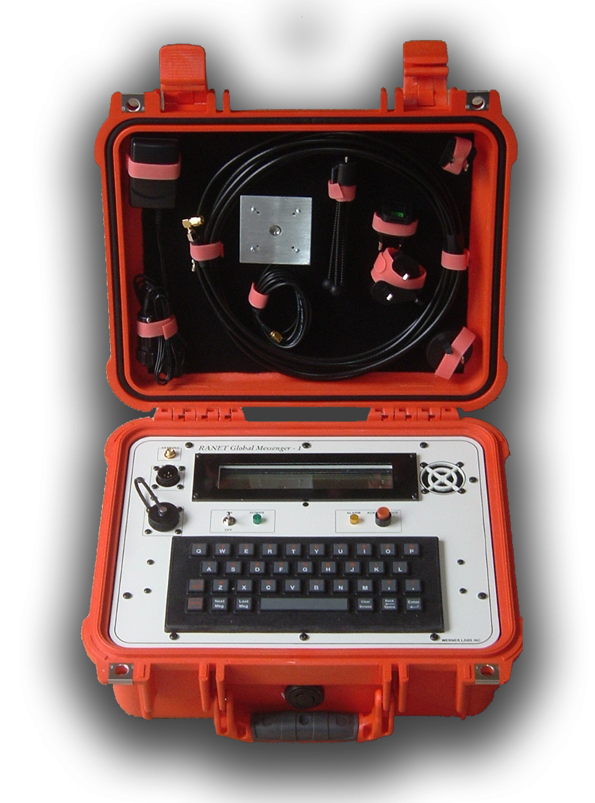
Chatty Beetleis both a terminal and a system designed to provide text-based weather alerts to remote locations where other communication options are limited, unreliable, or when a text-based message is sufficient. The Chatty Beetle provides a…
… device for advanced warning of impending hazards while requiring minimal infrastructure!
GRAB IT AND GO
ALWAYS ON
HEADS-UP
The rugged, self-contained design provides a robust solution for emergency response situations
Developed in 2009 by RANET
space-based data
airborne data
in situ data
weather products
metadata
GEONETCastis a near real-time, global network of satellite-based data dissemination systems designed to distribute
…to many communities. GEONETCast is a successful development in the Global Earth Observation System of Systems (GEOSS), coordinated by the intergovernmental Group on Earth Observation (GEO). It is led by: