Innovative Instrumentation

3D-PAWS logo with text

3D-PAWS station in Fargo, North Dakota preceding a storm.

What is it?

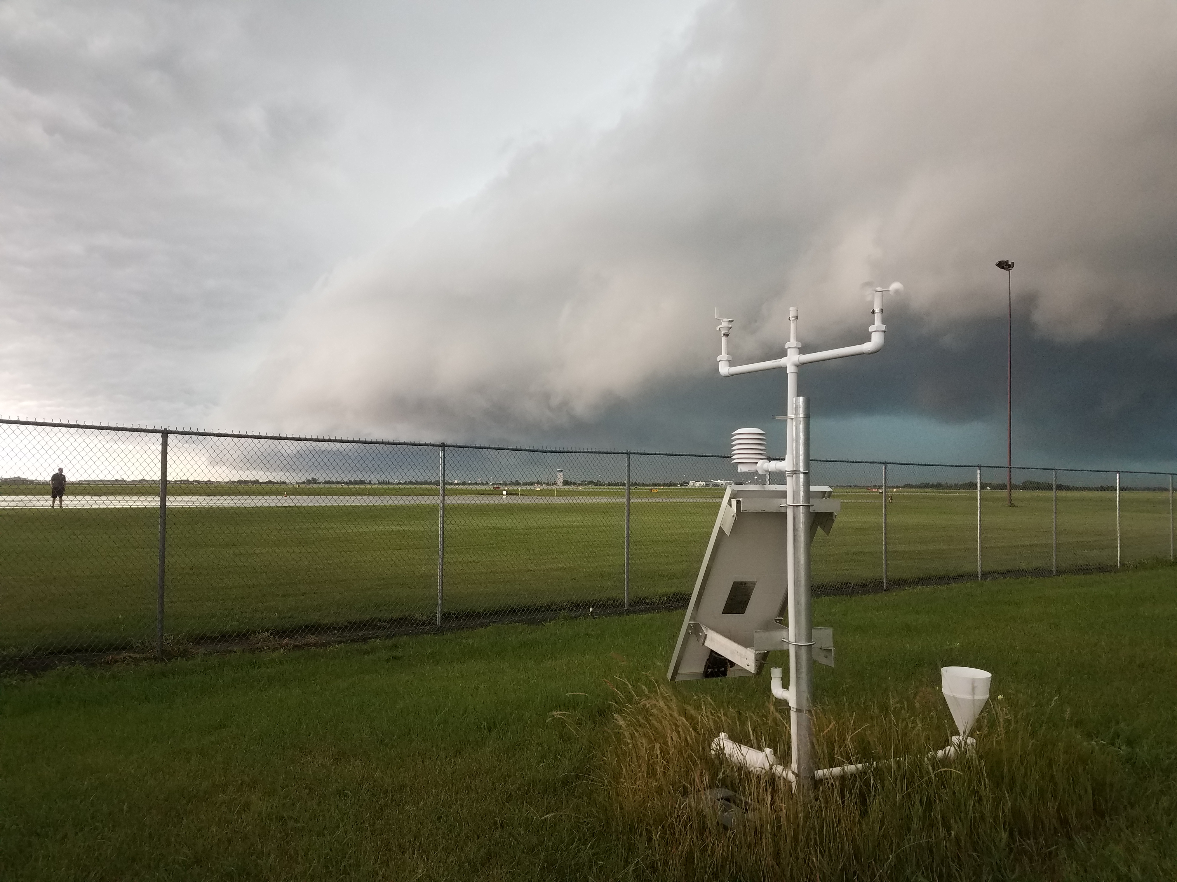
3D-PAWS (3D-Printed Automatic Weather Station) is an initiative to provide low-cost, reliable, and sustainable environmental observation platform solutions to primarily data sparse regions of the world. It was developed through funding from the US NWS International Activities Office (IAO), with support from the USAID Bureau of Humanitarian Affairs (BHA). 3D-PAWS also provides educational and outreach opportunities to build and deploy observation platforms for training purposes. 3D-PAWS sensors currently measure pressure, temperature, relative, humidity, wind speed, wind direction, precipitation, and visible, infrared, and UV light. New sensors are being developed to monitor water level (stream gauging), soil moisture and temperature, and air quality.

What are the benefits?

A 3D-PAWS surface weather station can be manufactured in about a week, at a cost of only $300 – 500

using locally-sourced materials, microsensor technology, low-cost single board computers, and a 3D printer. The system uses a Raspberry Pi single-board computer for data acquisition, data processing, and communications.

This system is uniquely designed with developing nations in mind.  It allows forecasters and emergency managers in these countries access to critical hydrometeorological information to make sound decisions pertaining to weather hazards.

Expanding observation networks and applications

Re-print and replace components
Affordable, reliable, and widely available materials

Local assembly at Meteorological Offices in-country

Local agency ownership

Better communication of weather and climate info to rural communities

Reduced weather and hydrology related risk in data sparse regions

Where is 3D-PAWS?

Research Facilities
Schools
Colleges
Hydro-meteorological Offices
Rural Missions
Radio Stations

3D-PAWS systems have been deployed in dozens of countries across 5 continents. COMET has partnered with schools, radio stations, non-government organizations, non-profit organizations, national meteorological and hydrological services, and international research institutes to expand 3D-PAWS networks around the globe. The primary focus at the hydrometeorological offices is on testing and evaluation. The other deployments around the world are being used for education, assessment, and other applications.


3D-PAWS real-time data are available on the CHORDS project data servers:

3D-PAWS (for testing and evaluation)

CHORDS (Cloud-Hosted Real-time Data Services for Geosciences) is a US National Science Foundation (NSF) EarthCube initiative to provide a platform for sharing geosciences datasets. It is supported and managed by the UCAR/National Center for Atmospheric Research (NCAR) Earth Observing Laboratory (EOL).

Want to build a station?

Find a full guide on parts and tools to buy, instructions to build, and 3D-print design files within our online manual.

 You can also find the Raspberry Pi software needed for testing, calibration, and operations on Github.